Adding a Multi Modal Segment to the S.F. Bay Trail along Carquinez Strait
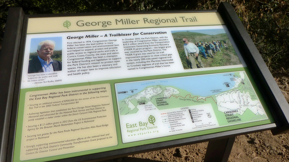
San Francisco Bay Trail: George Miller Regional Trail (formerly Martinez Intermodal to Crockett) | Contra Costa County, CA
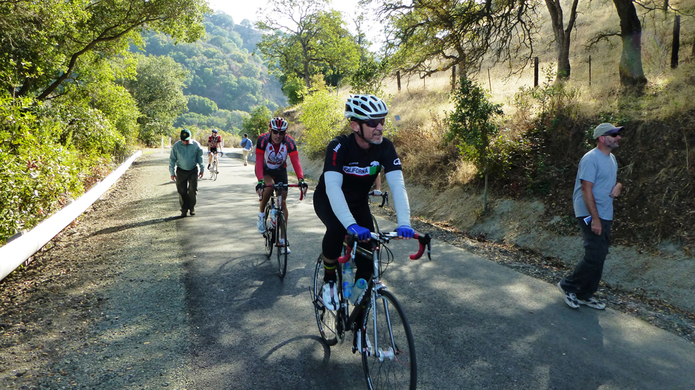
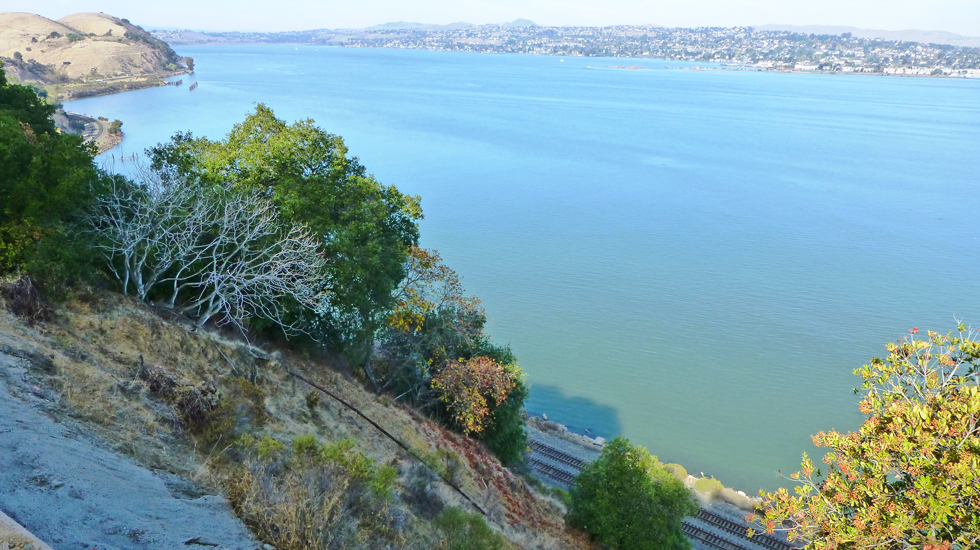
The East Bay Regional Park District (EBRPD) constructed a multi-use bicycle/pedestrian trail (project) to connect the City of Martinez Intermodal Transit Center to the Town of Crockett along a 1.7-mile-long section of Carquinez Scenic Drive, a county road west of Martinez that was closed to automobile traffic after El Niño landslides in 1982. The project is a key segment of the San Francisco Bay Trail, an approximately 500-mile network of trails encircling San Francisco and San Pablo bays. The winding road followed the steep slopes above Carquinez Strait, a significant Bay Area waterway, and provided a variety of views of local landmarks and regional landscapes including the river delta region, surrounding coastal hills, the working waterfront with passing trains traveling along the shoreline, and tugboats and freighters moving along the waterway. Adjacent vegetation enhanced the appearance of an otherwise abandoned and neglected roadway and provided habitat for a variety of foraging birds and mammals, perches and nest sites for raptors, and cover for prey. Key endangered species include California red-legged frog and Alameda whipsnake.
In improving the roadway as a multi-use trail, the project included slope and road embankment stabilization (including landslide repair), pavement repairs, reconstruction and overlay, and repair or enhancement of existing drainage infrastructure. As a subconsultant to the Project Engineers, LSA identified potential constraints related to biological and cultural resources so engineers could incorporate impact avoidance and minimization measures into the design. As a federally funded project, LSA prepared technical reports to document compliance under the National Environmental Policy Act (NEPA) and Caltrans Local Assistance Procedures including a Natural Environment Study (NES), Biological Assessment (BA), a Traffic/Noise Technical Memorandum, a Water Quality Assessment, a Visual Technical Memorandum, an Archaeological Survey Report (ASR), a Historical Resources Evaluation Report (HRER) and a Historic Property Survey Report (HPSR). LSA prepared required regulatory permits (CDFW and RWQCB) on behalf of EBRPD and performed construction monitoring for both biological and cultural resources to ensure compliance with all permit conditions. Construction started in June 2013 and the trail opened for public use in November 2014. LSA is conducting ongoing monitoring of the revegetated areas and submitting annual reports to the RWQCB for the next 5 years.

Client
East Bay Regional Park District
Services
CEQA/NEPA; Biological and Cultural Resources; GIS/GPS; Transportation; Regulatory Permitting; Construction Monitoring
![]()